Printing a Map
In MapStore it is possible to print a map by selecting the Print  button from Side Toolbar. The print process is composed by two main steps:
-
Print Settings definition
-
Result checking in Preview before download the printed file
Print settings
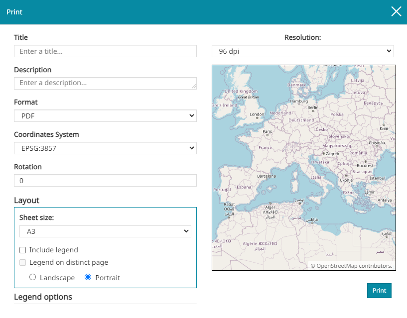
As soon as the Print  button is chosen, the following window opens:

Through this window it is possible to:
-
Enter a Title and a Description, that will be shown on the print page
-
Change the Format (
PDF,PNG,JPEG) -
Change the Coordinates System (
EPSG:3857,EPSG:4326) -
Change the Rotation of the map (value in degrees)
-
Change the Resolution of the print (
96 dpi,150 dpi,300 dpi) -
Accessing Layout settings
-
Accessing Legend options
Note
In Print settings preview there's the map portion that will be displayed on the print sheet. In order to center the map the user can pan it until the preview displays the desired extension
Layout
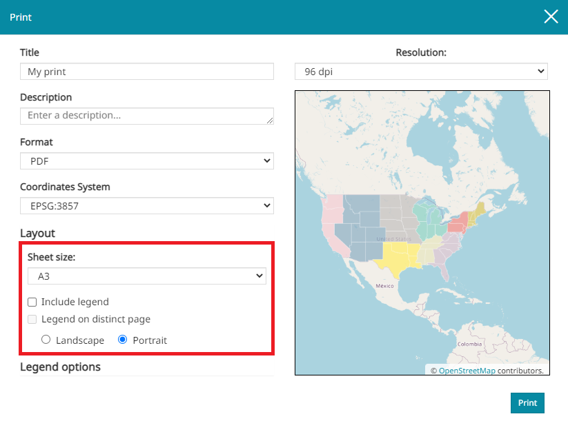
Opening the Layout settings menu, the following menu appears:

From here, in particular, it is possible to:
-
Select the Sheet size (choosing between A3 and A4 format)
-
Choose to Include legend
-
Choose to place the Legend on distinct page from the map
-
Select the page orientation between Landscape and Portrait
Legend options
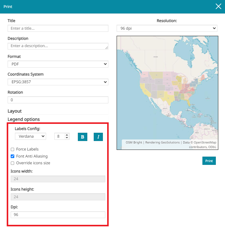
The Legend can be customized through the Legend options menu:

Through this menu the user is allowed to:
-
Configure labels by choosing font type and size, and by adding Bold and Italic style
-
Enable the Force Labels option, that force the display of labels even if only one rule is present (by default, if only one rule is present, the label is not displayed)
-
Enable the Font Anti Aliasing (when Anti Aliasing is on, the borders of the labels font are smoothed improving the image quality)
-
Enable the Override icon size option to have the ability to change the Height and Width of the icons (by default, the icon sizes are
24x24) -
Set the Dpi resolution of the legend
Preview
When the print settings are chosen, it is possible to access the preview by clicking on the  button. A window similar to the following appears:

Here it is possible to:
-
Zoom in/out int the preview

-
Navigate between pages (when more than one page is present)

-
Download the file in .pdf format

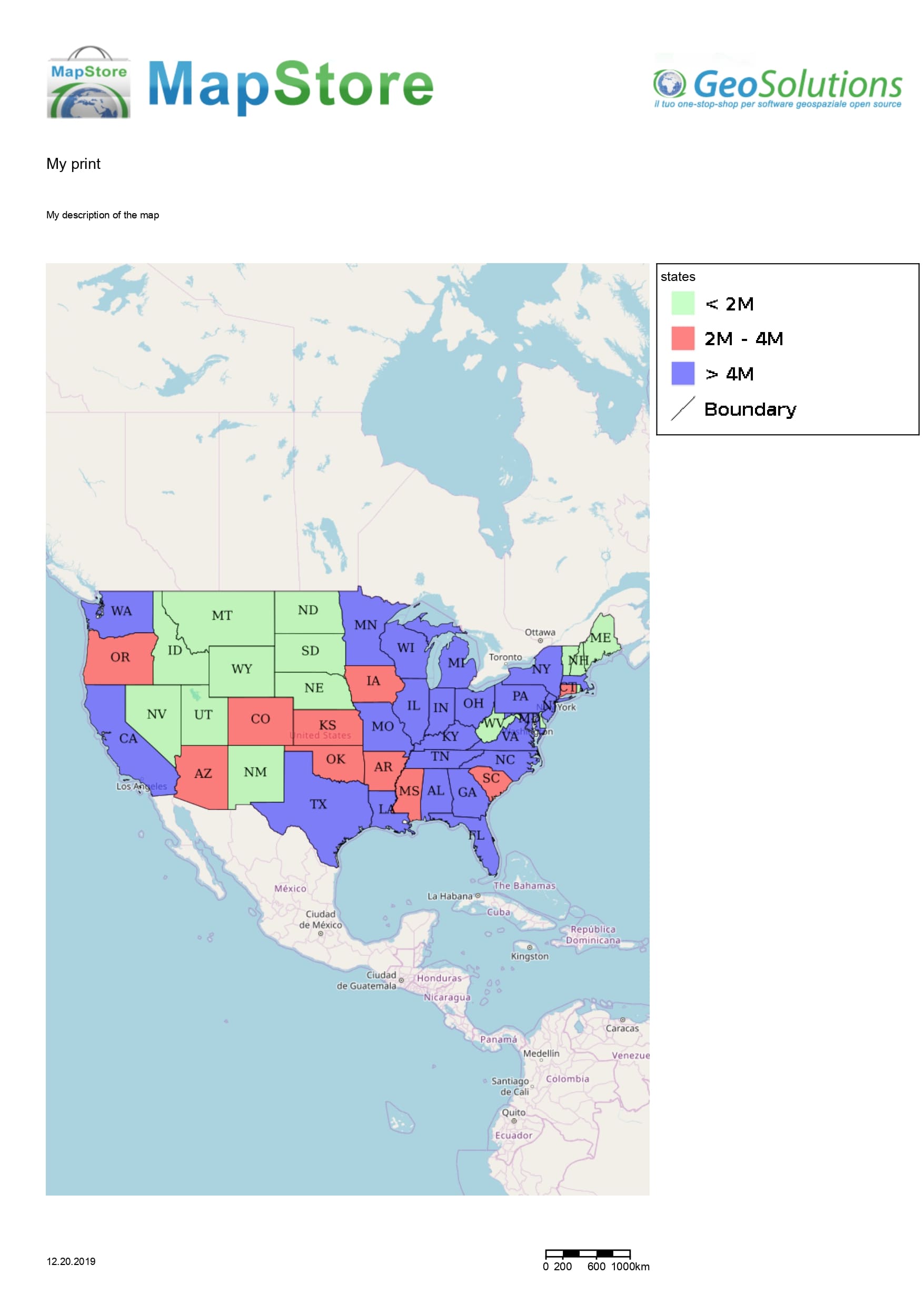
A simple printed map could be, for example, like the following:
